After a morning at sea making our way south, National Geographic Orion reached the amazing volcanic complex of Krakatoa (a.k.a. Krakatau) located in the Sunda Strait between the islands of Java and Sumatra. At one time, Krakatoa was just one island consisting of three interconnected cones, known as Rakata, Danan, and Perboewatan. However, on August 26, 1883, there was an unexpected series of explosions, followed the next day by the biggest volcanic explosion in history. This massive eruption blew Danan and Perboewatan to bits. The section of the island where the eruption occurred was originally 800 m (2,600 ft) above water, but after the eruption, the volcanic structure was 300 m (1,000 ft) below the surface. The explosion was heard by the inhabitants of Rodriguez Island, about 8,000 km (5,000 mi) across the Indian Ocean. Within minutes, a great surge of displaced water, i.e. a tsunami, drowned 36,500 people in the coastal areas of western Java and southern Sumatra. An air pressure wave was recorded on barographs around the world, and fine dust particles rose to great heights and were distributed around the globe. This caused abnormally colored sunsets, and the sun appeared with a reddish‑brown circle around it (this phenomenon is known as a Bishop's Ring). By 1930, the submerged region of the volcano had rebuilt itself enough to emerge above the sea surface as a new cinder cone known as Anak Krakatoa (Child of Krakatoa). It has been growing ever since.
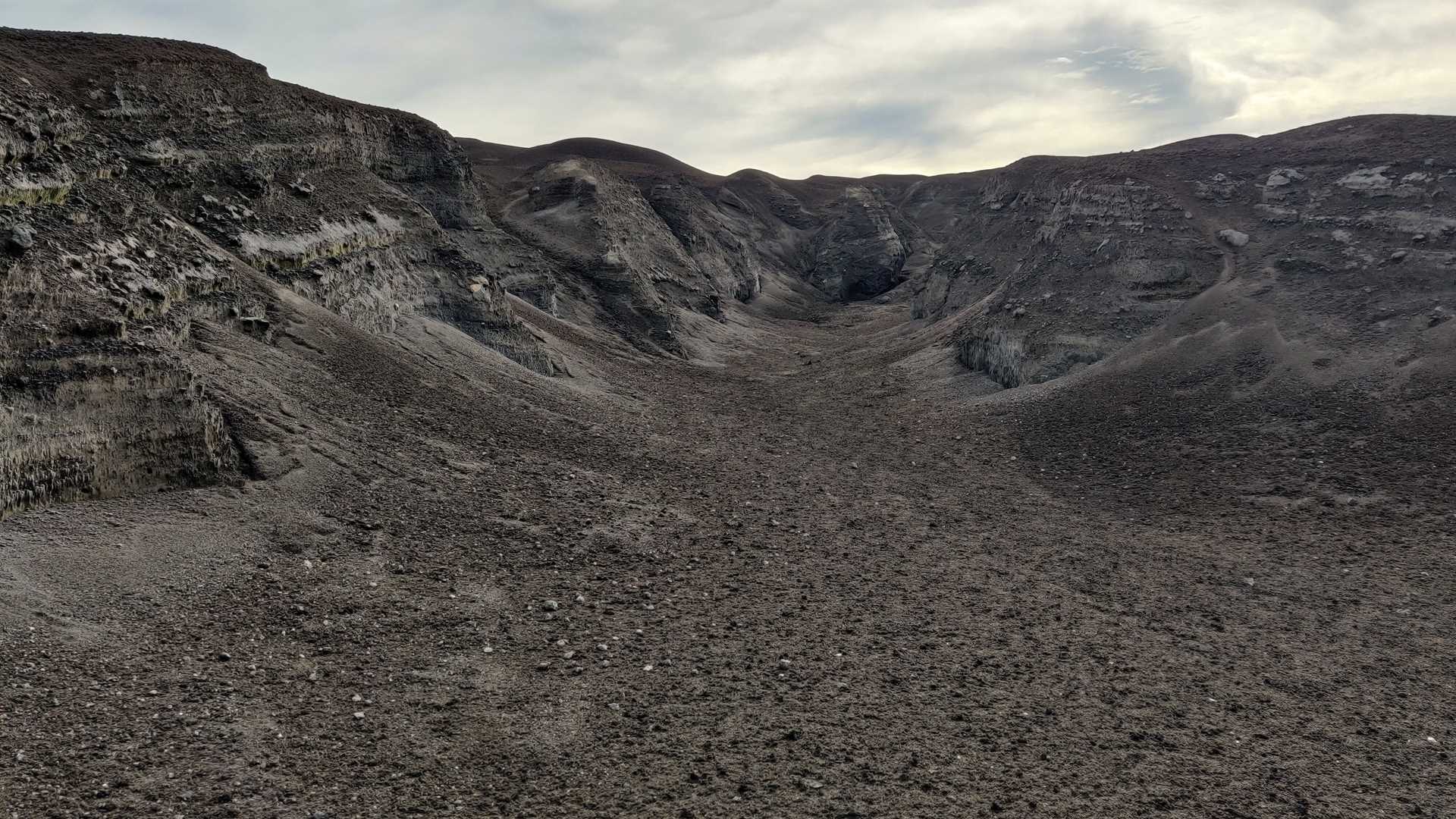
After undergoing a rather lengthy clearance with the local authorities, we anchored off the east coast of Anak Krakatoa in the early afternoon and took everyone ashore to explore what must be the most famous volcano in the world. It is pretty barren of vegetation today, but up until four years ago, there was an extensive forest scrub environment near our landing place. The plant life was destroyed and washed away by a tsunami in 2018, which was caused by an eruption and underwater collapse on Anak Krakatoa. It was interesting to explore the eroded ravines (photo 1) because we could clearly see the exposed layering effect caused by many years of successive eruptions. Some distinct layers showed signs of major eruptions that included lots of ejected missiles and bombs of solid basalt, whereas most of the layers consist primarily of fine volcanic ash (photo 2). Many of us hiked up to the edge of the main crater (photo 3) and got a real feel for the power of the place. We could not actually see the vent itself from this position, but the sound of the escaping gas was awesome. Everyone agreed it sounded like a bunch of huge jets taking off, one after another, from some unseen airport. We had everyone back aboard by sunset. A little later, the ship circumnavigated the island, and we were entertained by a distinctive red glow at the crater region. Those with binoculars could actually see glowing missiles and small rocks ejected high into the sky. Seeing and landing on this historically significant volcano was like a dream come true for most of us.