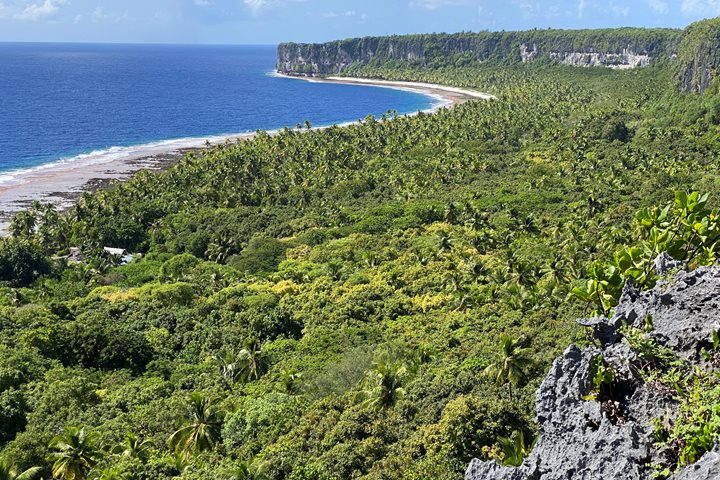
Our expedition to Polynesia began in Easter Island, also known as
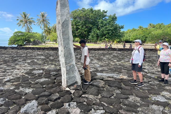
Easter Island was colonized by Polynesians probably between AD 900 and 1000, according to the latest radiocarbon dates. They spoke an eastern Polynesian dialect that was related to Marquesan and Hawaiian and linguists have estimated Easter Island language has been isolated for more than a millennium. When we think of Easter Island, we think of bizarre and fascinating megalithic statuary. The giant stone statues represent deified ancestors and were once an important, actually dominating, part of the island’s culture. There are about 900 moai known to exist. The design and style of these incredible statues, or moai, evolved here in isolation and are unlike any other statues found in Polynesia (or the rest of the world, for that matter). The moai were erected facing inland in order to watch over and protect the living descendants with manna provided by the departed ancestors represented by the statues. Apart from some of the unfinished moai still situated at the main quarry, all of them had been knocked down (some by earthquakes, but most by rival clans) by the end of the 19th century.
Jacob Roggeveen was the first European to sight Rapa Nui. This occurred on Easter Sunday, 1722, which is why we know it as Easter Island. Therefore, the written history of this fascinating lace is only about three centuries. The rest of our knowledge has come from careful archaeological research and local oral traditions. We missed Easter day on Easter Island by just two days. Here is a recap of our experiences at Easter Island.
Wednesday: After checking into our rooms at the beautiful Hangaroa Eco Village and Spa, we headed out to the restored Ahu Tahai for our first close-up views of the famed megaliths. This monument includes five moai, as well as a few isolated moai and some house foundations. Most of us opted to walk back to the hotel in the evening, which gave the chance to enjoy some free time and check out the town.
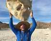
Thursday: Today, we concentrated our efforts in the eastern region of the island. Most of us opted to go out to Tongariki, the site of the largest Ahu on the island, in order to watch the sunrise. It was as beautiful as we had hoped. This was the site of a very large and extensive village at one time, and the restored Ahu contains 15 massive moai. A little later, everyone made their way to Rano Raraku, the most famous place on Easter Island. This is the quarry site where nearly all the moai found throughout the island were carved out of the western slope of the volcano. Many of the moai were abandoned before their carving was complete or before they were moved to the final sites. Numerous statues remain upright, mostly buried in the shifting volcanic ash sands, so that only their heads are exposed. A pathway system allowed us to view these wonderful megaliths up close and conditions were perfect for photography. We all then went over to nearby Tongariki (where many of us experienced the sunrise a few hours earlier) for more time to explore and learn about the human aspect of the site. The site was restored in the 1990s by some of those guiding us, notably Claudio, Patricia, and Edmundo. A barbecue lunch was offered at an old coconut plantation near Anakena Beach, the nicest white sand beach on the island, where we also had time to view more moai and swim in the protected waters. From here, some of us went by bus to nearby Ovahe and then hiked overland to Ahu Te Pito Kura.
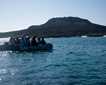
Friday: Today, we explored the southwestern area. For most of us, this started at Vinapu, a ceremonial complex with ahus and moai of different ages, including one stone monument very reminiscent of Incan stonework in Peru. Here the stones are closely-fitted rectangular shapes, which look very much like some of the ancient structures in the northern Andes of South America. We also visited the Orongo Caldera, where we learned about the amazing Birdman Cult. a yearly contest that pitted champions of the various clans against each other in a competition to obtain the first sooty tern egg of the season. The winning clan chief (and his people) enjoyed all kinds of benefits for the ensuing year, until the next competition. We saw the houses in which the important people lived during these events, and could easily understand the dangers involved with the competition when we looked at the little offshore islets where the competitors challenged each other. After lunch, we visited Ahu Akivi, the first restored site, which was overseen in the 1960s by Professor Bill Mulloy of the University of Wyoming. This operation set the standard for all ensuing restorations. We also had the chance to visit Puna Pau, where the red top knots that adorned the completed moai were quarried and shaped. And, some of us opted to explore the Ana Te Pahu lava tubes. However, only a few people actually went far enough inside the cave to climb out a different access point. In the late afternoon, we arrived back at Hangaroa and were met by Zodiacs, which transferred us onto National Geographic Orion, which is to be our home for the next couple weeks.