The morning found us in Jones Sound, near the southern coastline of Ellesmere Island. This is one of the largest islands in the Canadian Archipelago and it reaches farther north than any other land in the world, except for Greenland.
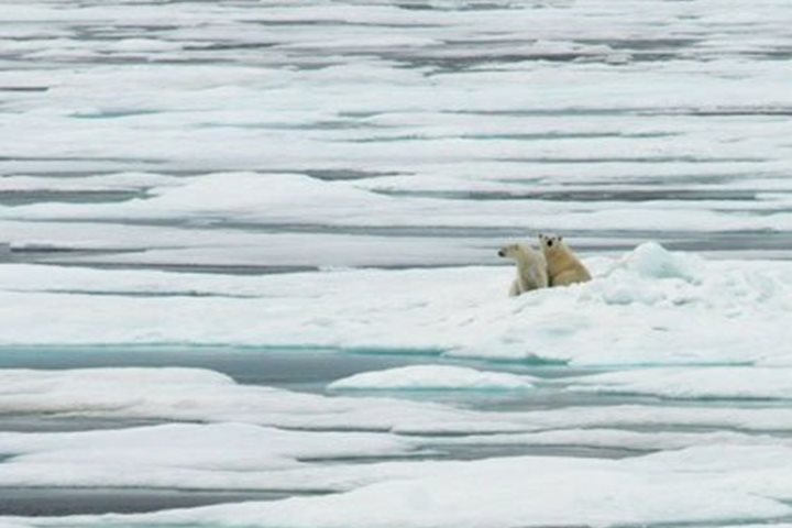
We entered Grise Fiord during breakfast and found a very inviting site on which to go ashore. After making sure there were no polar bears lurking about, we landed at the mouth of a glacial/river valley surrounded by ancient red granitic mountains. The construct of the valley floor and walls gave the impression that it may have been shaped by a cataclysmic flood that ensued from the breakage of an ice dam in the distant past. The exposed bedrock here is truly ancient, dating to more than 2.5 billion years in age. The geology shows that this island is essentially part of northern Greenland, which is but a short distance to the east separated by a narrow channel called Kennedy Strait. It is very different than anything we’ve seen in the rest of the Canadian Archipelago. The mixture of different types of rocks and pebbles lying about was impressive, as it included pieces of red granite, quartzite, sandstone, shale, and mudstone, many of which were shattered in place by freeze-thaw action.
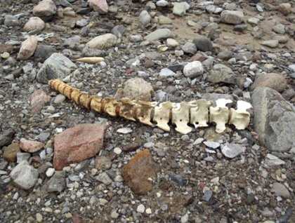
We also found some interesting marine life in the numerous sandy pools near the shoreline, including lion’s mane jellyfish and very active little amphipods. Numerous bones from seals and whales were found in the low areas close to the beach. Bones, especially large, bleached bones make great photography subjects, and are also good for discussions on comparative anatomy. Ellesmere Island is really remote and relatively little exploration and study has been accomplished here. It’s amazing to realize with all the exploration that has been done throughout this island archipelago, Ellesmere Island was circumnavigated for the first time only in 2011. Our morning stop was the farthest north we have reached on this voyage…76.5ºN latitude.
In the early afternoon, we sailed past the tiny hamlet known as Grisefiord on our way to the southeastern point of Ellesmere Island. The community only has about 100 residents, which is no surprise considering that this is actually one of the coldest inhabited places in the world with an average yearly temperature of -16.5ºC (2.3ºF). We considered making an unscheduled stop at the village, but decided the idea of 140 or so visitors might be overwhelming and make them uncomfortable, so we continued on.
Our quest was the Wilcox Glacier, one of the outflows of ice from the great Manson Ice Field that covers much of Ellesmere Island, making it the largest ice cap in the northern hemisphere, outside of Greenland. It took several hours to reach the glacier, which was described in the pilot book as a beautiful tidewater glacier with an ice front measuring more than seven nautical miles. Our captain had been here in the 1980s and remembered it as being very impressive. When we came around the point and got our first view of it, we were surprised to see the ice front had retreated several miles and the glacier is now, for the most part, land-locked. The accompanying photograph was taken at the position where the ice front used to be located just a few years earlier. Also, this position put us directly across the head of Baffin Bay from the Thule Air Base in western Greenland. It was interesting that the North Magnetic Pole was about 30º to the west of true north relative to our position. Fortunately, we don’t rely on old-fashioned magnetic compasses any longer. And, we were only about 2.5º south of the North Geomagnetic Pole.