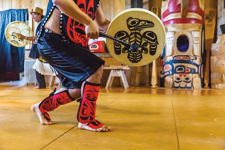
Exploring the British Columbian Archipelago’s Most Remote Sacred Site By Marc Cappelletti I am walking in the footsteps of chiefs and carvers, warriors and weavers, shamans and slaves; people as connected to the land as the very trees from which they once made their homes. The ground is soft. It is sacred. And it lies at the edge of the world—Haida Gwaii, British Columbia. We are at the ancient village of SGang Gwaay Llnagaay, formerly known as Nan sdins or Ninstints, on the eastern edge of SGang Gwaay (Anthony Island).
When we, as Canadians, talk about our whole country, we say “from coast to coast to coast.” The three coasts feel very different underfoot. In the west, deep moss makes a trail that feels like walking over sofa cushions; in the east, long grasses swish and slap against your boots; and up north rocks and rivulets form tiled patterns over the permafrost. It was the west coast that convinced me to start working at sea.
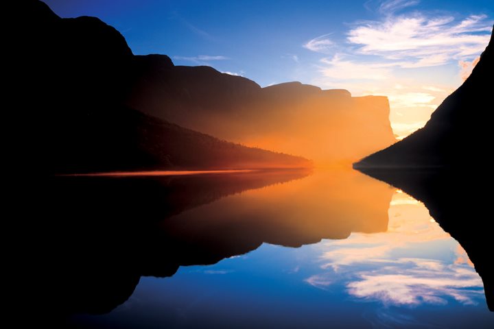
Newfoundland’s Gros Morne National Park is one of the few places where you can walk on the Earth’s mantle and also cruise glacially carved freshwater fjords.
In this episode of Expedition Spotlight, join Cultural Specialist Susan Flanagan as she reveals what discoveries are in store on our Canadian Maritimes and Newfoundland expedition.
After clearing customs, National Geographic Quest made its way deep into the stunning and massive fjord walls of Misty Fjords, en route through Behm Canal and Rudyard Canyon towards God’s Pocket. We had a delicious brunch and then disembarked for kayaking and Zodiac tours. We enjoyed the lovely and serene views, including waterfalls, lush landscapes, and many ducks. You could say it was very…gneiss! On our way north, we ran into an unexpected visitor… the sun! While it didn’t last long, it did mean we had a full bow of guests enjoying the day. Onwards towards Petersburg!
Our first full day had plenty of wonderful surprises as we disembarked in Puerto Ayora, the main town on Santa Cruz Island. As soon as we arrived, we took a bus all the way to the highlands of Santa Cruz until we reached El Trapiche Farm, a unique site where the guests of National Geographic Islander II learned about the production of organic coffee, cocoa, and sugarcane liquor. Afterwards, we visited the Twin Craters. This amazing site is comprised of two incredible pit craters formed by the collapse of volcanic magma chambers. The area is surrounded by a forest of the unique Scalesia pedunculata, a tree that is endemic to the area. The spectacular visit to El Manzanillo Ranch gave us the opportunity to walk among the incredible Galapagos giant tortoises, often found in the early afternoon having lunch and resting. Being surrounded by these gentle giants was the best way of ending our visit.
Our day on San Cristóbal Island began at Pitt Point, the island’s easternmost landing site. As we climbed the rugged trail through eroded tuff formations, we were greeted by the sight of red-footed boobies nesting in the Galapagos clubleaf while blue-footed boobies performed their signature courtship dance along the path. In the late morning, we made our way to the dreamy white coral beach of Witch Hill, a tranquil stretch of sand framed by turquoise waters and dramatic volcanic formations. Galápagos sea lions slept peacefully under the sun while ghost crabs darted playfully between their tracks. Offshore, the striking silhouette of Kicker Rock stood like a cathedral in the sea, a preview of our afternoon adventure. As the sun dipped lower, we explored Kicker Rock by panga. Towering nearly 500 feet above the sea, these twin tuff cones cleaved by a narrow channel offered dramatic views both above and below the surface. Bottlenose dolphins were traveling along the coastline of San Cristobal while our guests enjoyed their presence from the decks of National Geographic Gemini . From land to sea, from cliffs to coral sand, today captured the breathtaking diversity that makes San Cristóbal so unforgettable.
The first light of the morning woke us up accompanied by an array of loud and bodacious sounds. Welcome to the world of neotropic birds! Soon after, we took to the skiffs for our first exploration and, after a nutritious breakfast, we headed for a hike in the forest. In the afternoon we explored another caño (tributary) searching for, and finding, additional interesting wildlife.
We said it at the beginning of the trip, and we meant it…this is not a cruise, it’s an expedition! Today’s plan was to land at Sundneset but when we arrived, we found the site completely blocked by ice. No problem. Within five minutes, the expedition leader and the bridge team had a plan B, a landing on another island just 30 minutes away. And what a plan B it was! A beautiful, icy beach that has witnessed over four centuries of Arctic history, including whalers, trappers, and scientists, all passed through here leaving behind countless stories that helped bring this place to life for our guests. Spring is slowly arriving on the island of Edgeøya. The snow is beginning to melt, the first birds are returning, plants are starting to grow, and reindeer were happily grazing near the landing site, starting their recovery after a long, harsh winter. This place is still mostly black and white, but in just a few weeks, it will be alive with greenery, flowers, and wildlife. A vivid reminder of the ever-changing nature of the High Arctic. Now we say goodbye to the high latitudes of Svalbard and begin our journey south to Bear Island—a solitary rock in the middle of the Barents Sea, and our final stop in this remote archipelago. The adventure continues!