We enjoyed a calm passage from Bergen, Norway to the Orkney archipelago, off the northeast coast of Scotland. We landed before noon at Kirkwall on the largest and main island, named the Mainland. Around the ninth century, Norse settlers reached Orkney. They occupied the islands until the fifteenth century when it became part of Scotland.
King James III granted Kirkwall the status of a royal burgh in 1486, and it remains the largest town in Orkney and home of St. Magnus Cathedral, its steeple visible from the pier. Built of brilliant ochre and red sandstone, it was named after Magnus Erlendsson, a Norse nobleman and Orkney’s first Christian martyr.
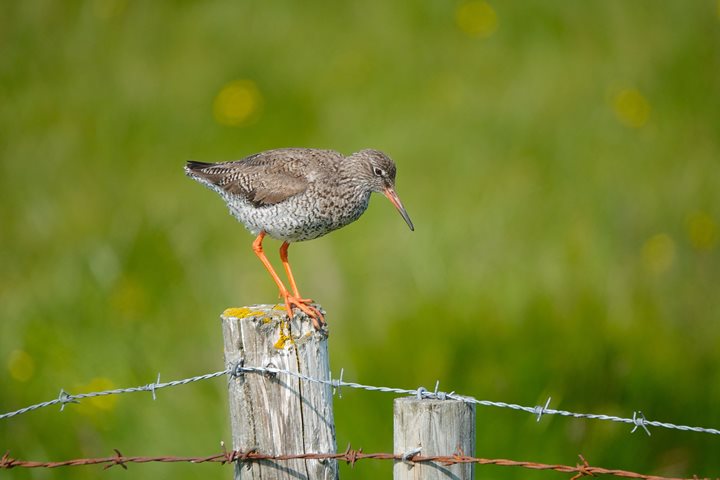
After lunch, our group left in a steady Scottish mist, driving through a striking landscape of fenced pastures with herds of Angus cattle and flocks of sheep, many freshly shorn of their wool. Fields of green barley and others of grass flanked the narrow road. Farmers cut the grass for silage to get their animals through the winter months. Heavy rolls of hay, wrapped in black plastic, were stacked next to the farmers’ barns.
Our destination included two of Orkney’s Neolithic archaeological treasures. When we first arrived, the rain stopped. For the next few hours, we enjoyed glorious weather and dramatic skies full of an ever-changing display of clouds. Approaching the standing stones at the Ring of Brodgar, we walked through fields of wildflowers, bright with buttercups, yellow rattles, Yorkshire fog grass, meadowsweets, vetches, docks, cow parsnips, bog cottons, selfheal, purple orchids, bell heathers, and both red and white clovers. Sited on a narrow band of land between freshwater Loch of Harray and the seawaters of Loch of Stennes, we walked around the outside of the stone circle. The ditch surrounding the standing stones was excavated from the bedrock–up to 13 feet deep and 32.5 feet wide.
What were we seeing? What was this ritual landscape we’d entered?
The Neolithic period was the last chapter of the Stone Age. Hunter-gatherers–who had fished, hunted, and collected wild plants–settled in villages to farm and raise domesticated animals. This transition occurred over millennia, beginning about 10,000 B.C. in the Levant, located around the eastern Mediterranean.
These changes didn’t reach Britain and Ireland until 4300 B.C., probably through immigrants from the continent who brought with them cattle, pigs, and sheep, as well as seeds for farming wheat, barley, and other vegetables. As they settled, they transformed the country. They became more sedentary by necessity, and for the first time, they produced pottery as well as finely made axe heads, arrowheads, and knives. They built large rectangular timber houses or halls. Showing a willingness and ability to work together, they embarked on public projects. They created community works with a burgeoning desire to make permanent marks on the landscape.
After the initial immigration across the English Channel, primarily from coastal areas of present-day Brittany, Normandy, Belgium, and the Netherlands, local distinctions appeared throughout Britain and Ireland as people responded to their regional environments. Monuments to the dead arose between 4200 and 3800 B.C. as communities placed their deceased in passage graves, long barrows, burial cairns, tombs, and chambers, often waiting a generation or much longer before sealing them. Many were collective burials assembled over time. By leaving a mark on their landscape, they were creating an identity and a history.
They embarked on enclosing spaces in causewayed enclosures, especially in southeastern Britain, by digging oval or circular ditches, building up the lip from what they excavated, and also creating monumental parallel ditches or trenches, which archaeologists call cursus. Again, these were marks on the landscape, declarations that someone had lived in this spot and created this monument for all to see after they died.
The earliest henge monuments began here in Orkney, then spread throughout the isles–Stonehenge, Avebury, and Callanish being the most famous. What did they signify? We don’t know. A round shape seemed important, but to what end? A circle is easy to lay out. Anyone with a stake and a length of cord or rope can do it. Does it suggest a sacred space? When communities erected these stones, what concepts and beliefs were they representing? What we see today at many sites are just the underpinnings, the barebones of what once stood proudly and ultra-modern thousands of years ago. The original builders might not even recognize their work if they were to see them today. While the original history and meaning might be lost through time, the monuments remain.
Who doesn’t appreciate an enigma? In the third millennium, henges and standing stones became so ubiquitous across the isles that archaeologist Barry Cunliffe suggests, “the entire landscape seemed to belong to the gods.”
We then bussed to Skara Brae, Europe’s finest example of a Neolithic village. The pathway to the site was lined with plaques along the ground with reminders of historical events and monuments. Beginning with the date of 1969 when men landed on the moon, we walked five thousand years back in time, arriving at Skara Brae, dated 3100 B.C. Situated above a lovely white sand beach on the Bay of Skaill, the archaeological site is comprised of eight interconnected drystone houses, featuring flagstone furniture and a central hearth. The village was covered by sand dunes for millennia until uncovered by a serious storm in 1850. It was properly excavated by Professor Gordon Childe beginning in 1927.
We had time to explore and enjoy the history and maybe even wonder what it was like to have lived here. It seemed peaceful, hopefully much less stressful than our lives today. For Neolithic villagers, connectivity meant paying attention to their surroundings rather than searching for internet access.
Almost as soon as we started our return to Kirkwall and our ship, National Geographic Explorer, it started raining again. We drove past Scapa Flow, where the Germans scuttled their fleet of ships rather than handing them over to the British at the end of World War I in 1919. We passed the underwater grave of the Royal Oak, torpedoed by a German submarine in World War II, and Highland Park, the most northern whisky distillery in the United Kingdom.
After dinner, Jacob Edgar, our ethnomusicologist, introduced us to Saltfishforty, a local Orkney musical duo. Jacob reminded us that music is such an important language, redolent of many regional dialects. Douglas Montgomery played fiddle and guitar, while Brian Cromarty played guitar and mandola. They gave us a lovely aural demonstration of traditional Orkney music, including several of their own compositions. In return, we gave them a standing ovation. They could have played all night for us, but they were due at a wedding celebration where they would play until the wee hours, perhaps fueled with a festive wee dram of the local Highland Park.
What a magical day.