
Call +1.800.397.3348 or contact your travel advisor
Expedition Stories
Our fleet navigates the world in search of adventure. These are the stories they bring back…
Loading...
Loading...
Previous Reports
3/30/2018
Read
National Geographic Orion
Easter Island (Rapa Nui)
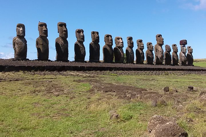
Our expedition to Polynesia began in Easter Island, also known as Rapa Nui (broad paddle) and Te Pito Te Henua (navel of the world). We spent three very fulfilling days exploring Easter Island, and in this time were able to see all the most important sites. This is perhaps the most isolated habitable land in the world, located 3,790 km (2,350 mi) west from Chile and 2,250 km (1400 mi) east from Pitcairn, the two nearest habitations. The island is triangular in shape, with an extinct volcano at each corner. It is relatively small and measures only 23 km (14 mi) E‑W by 11 km (7 mi) N‑S, covering about 166 sq km (64 sq mi) in area. However, the volcanic Plateau of Easter Island is much larger and measures some 250 km (150 mi) in circumference. The surrounding waters are more than 3,000 meters (10,000 ft) deep in some places. Easter Island was colonized by Polynesians probably between AD 900 and 1000, according to the latest radiocarbon dates. They spoke an eastern Polynesian dialect that was related to Marquesan and Hawaiian and linguists have estimated Easter Island language has been isolated for more than a millennium. When we think of Easter Island, we think of bizarre and fascinating megalithic statuary. The giant stone statues represent deified ancestors and were once an important, actually dominating, part of the island’s culture. There are about 900 moai known to exist. The design and style of these incredible statues, or moai, evolved here in isolation and are unlike any other statues found in Polynesia (or the rest of the world, for that matter). The moai were erected facing inland in order to watch over and protect the living descendants with manna provided by the departed ancestors represented by the statues. Apart from some of the unfinished moai still situated at the main quarry, all of them had been knocked down (some by earthquakes, but most by rival clans) by the end of the 19th century. Jacob Roggeveen was the first European to sight Rapa Nui. This occurred on Easter Sunday, 1722, which is why we know it as Easter Island. Therefore, the written history of this fascinating lace is only about three centuries. The rest of our knowledge has come from careful archaeological research and local oral traditions. We missed Easter day on Easter Island by just two days. Here is a recap of our experiences at Easter Island. Wednesday: After checking into our rooms at the beautiful Hangaroa Eco Village and Spa, we headed out to the restored Ahu Tahai for our first close-up views of the famed megaliths. This monument includes five moai, as well as a few isolated moai and some house foundations. Most of us opted to walk back to the hotel in the evening, which gave the chance to enjoy some free time and check out the town. Thursday: Today, we concentrated our efforts in the eastern region of the island. Most of us opted to go out to Tongariki, the site of the largest Ahu on the island, in order to watch the sunrise. It was as beautiful as we had hoped. This was the site of a very large and extensive village at one time, and the restored Ahu contains 15 massive moai. A little later, everyone made their way to Rano Raraku, the most famous place on Easter Island. This is the quarry site where nearly all the moai found throughout the island were carved out of the western slope of the volcano. Many of the moai were abandoned before their carving was complete or before they were moved to the final sites. Numerous statues remain upright, mostly buried in the shifting volcanic ash sands, so that only their heads are exposed. A pathway system allowed us to view these wonderful megaliths up close and conditions were perfect for photography. We all then went over to nearby Tongariki (where many of us experienced the sunrise a few hours earlier) for more time to explore and learn about the human aspect of the site. The site was restored in the 1990s by some of those guiding us, notably Claudio, Patricia, and Edmundo. A barbecue lunch was offered at an old coconut plantation near Anakena Beach, the nicest white sand beach on the island, where we also had time to view more moai and swim in the protected waters. From here, some of us went by bus to nearby Ovahe and then hiked overland to Ahu Te Pito Kura. Friday: Today, we explored the southwestern area. For most of us, this started at Vinapu, a ceremonial complex with ahus and moai of different ages, including one stone monument very reminiscent of Incan stonework in Peru. Here the stones are closely-fitted rectangular shapes, which look very much like some of the ancient structures in the northern Andes of South America. We also visited the Orongo Caldera, where we learned about the amazing Birdman Cult. a yearly contest that pitted champions of the various clans against each other in a competition to obtain the first sooty tern egg of the season. The winning clan chief (and his people) enjoyed all kinds of benefits for the ensuing year, until the next competition. We saw the houses in which the important people lived during these events, and could easily understand the dangers involved with the competition when we looked at the little offshore islets where the competitors challenged each other. After lunch, we visited Ahu Akivi, the first restored site, which was overseen in the 1960s by Professor Bill Mulloy of the University of Wyoming. This operation set the standard for all ensuing restorations. We also had the chance to visit Puna Pau, where the red top knots that adorned the completed moai were quarried and shaped. And, some of us opted to explore the Ana Te Pahu lava tubes. However, only a few people actually went far enough inside the cave to climb out a different access point. In the late afternoon, we arrived back at Hangaroa and were met by Zodiacs, which transferred us onto National Geographic Orion, which is to be our home for the next couple weeks.
4/1/2018
Read
National Geographic Orion
At Sea, Approaching the Pitcairn Group
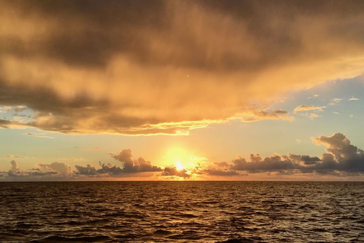
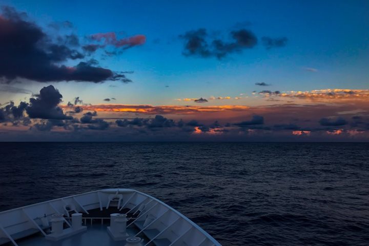
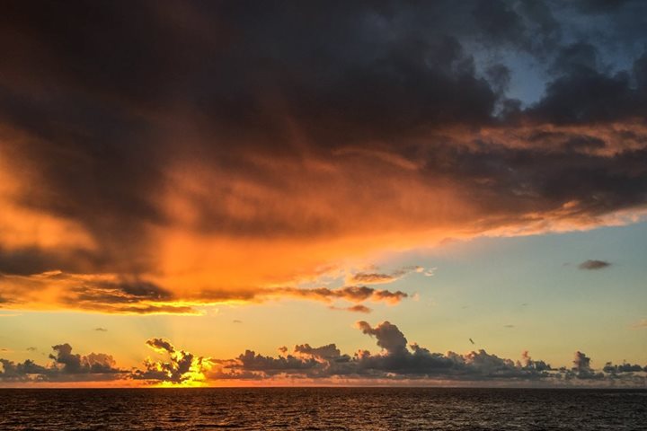
This is our second day at sea, crossing brilliant blue waters under bright sunshine in the far southeast corner of Polynesia. The incredible expanse of the Pacific, the largest physical feature of the planet, surrounds us and envelopes us in its own distinct world, in the true nature of our world, Planet Ocean. The surface of the earth is mostly ocean, more than twice as much water as there is land. Think about that. All the land you’ve ever seen, near your home and in distant destinations, around the car on long drives and far below on cross-country flights, multiplied by two, still doesn’t equal the area of all the world’s oceans. This may give a small window into the world we are traveling through now, with the deep blue water extending to the distant horizon all around us. The sky is the other half of this world, and it is as full and ever changing as the surface of the sea is featureless. The ocean changes day by day, sometimes in just a few hours, as storms and sets of swells come and go, but the cloudscapes of the tropical Pacific change every minute, from the first light before sunrise until the light fades again in the evening. There is almost always a beautiful layer of small, puffy cumulus clouds low over the sea, moving quickly in the surface winds. Sometimes the larger ones trail grey tails of heavy rain below their flat bottoms, squalls that come and go in a few minutes. Much higher in the sky there are multiple layers of cirrus and alto-cirrus, usually only wispy horsetails, sometimes gathering into broad, textured mackerel skies. The sunrise and sunset light play through these various clouds like a symphony, one layer after another, golds and pinks and purples swelling and fading like movements of music, building to a crescendo, then slowly fading into day or darkness. This is the true face of Planet Ocean, our home.
4/3/2018
Read
National Geographic Orion
Henderson Island, Pitcairn Group
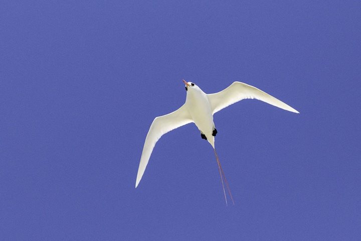
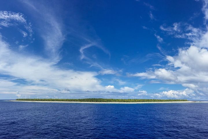
Our wonderful luck with weather and sea conditions continued today, allowing us to make a rare landing on Henderson Island, an uplifted mass of coralline limestone, quite different from Ducie Atoll. The forest above the landing was quite thick, but we were able hike a short way into the trees where some of us saw two exciting endemic birds, the Henderson Island reed warbler and the Henderson Island parakeet, both species that are found only on this tiny speck of land and nowhere else in the world!
4/5/2018
Read
National Geographic Orion
South Pacific Ocean, Towards Mangareva
We awoke this morning to the crackling of thunder as we steamed northwest towards Mangareva. The cloud cover was a very welcomed reprieve from our busy day on Pitcairn Island, providing us the opportunity to cool off, stretch our legs and recharge for a full day at sea. After breakfast we learned about the geology of Polynesia and how to capture its beauty with the handy smartphone. After lunch we learned about the corals of the tropical Pacific Ocean and partook in a spirited conversation on climate change. There was much to do today, whether out on deck, listening to presentations in the lounge or finding a quiet spot to edit photos. But mostly, today was about rest, reflection, and anticipation for the adventures to come in the Gambier Islands.
4/7/2018
Read
National Geographic Orion
Tenararo Atoll, French Polynesia
It was another spectacular day in paradise today in French Polynesia. We were fortunate to have a surprise stop at Tenararo Atoll this morning to enjoy the ocean and everything within it. During breakfast, the expedition team prepared the platform for snorkeling and the glass bottom zodiac for viewing the underwater world from the comforts of a dry and shaded boat. By the time we finished breakfast, everything was ready and the exploration began. Those that were certified to dive ventured off with the various dive masters to get really up close and personal with the fantastic reef that surrounds this atoll. The rest of the day was spent at sea, enjoying the comforts of the ship as we ventured off to our next destination. The light winds and scattered clouds made for a perfect setting to spend some time on deck getting some sun and enjoying the jacuzzi. We also learned how to better process our photos from our photo instructor and enjoyed a tour of the galley, where all of our delicious food is prepped. It could not be a more idyllic day here in the South Pacific.
4/9/2018
Watch
National Geographic Orion
Raroia Atoll, Tuamotus, French Polynesia
Today we explored the stunning atoll of Raroia. With beaches fringed with palm trees and turquoise blue lagoons, our arrival this morning felt like a true welcome to a French Polynesian paradise. Snorkeling, swimming, and exploring were on the menu today, and everyone aboard enjoyed some time in the sun and sea.
3/31/2018
Read
National Geographic Orion
At Sea from Easter Island to Ducie Atoll
After two fabulous nights on Easter Island it was time to begin the sea portion of our voyage through Polynesia. We boarded our new home last night, and set off to the northwest towards the Pitcairn group. Our journey to our first island, Ducie, will take two full days at sea. A fiery sunrise started our day. After a breakfast on the outer deck, it was time to wrap up our times spent on Easter Island and move on to the plans ahead. We learned about photography, navigation, and Polynesian culture. A few seabirds passed by and flying fish darted off in front of the vessel. But mostly, today was about getting used to the ship, and enjoying the beautiful conditions. Whether out on deck or merely staring out the window, the cobalt blue ocean was mesmerizing.
4/2/2018
Watch
National Geographic Orion
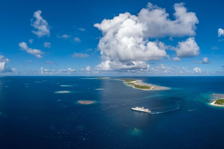
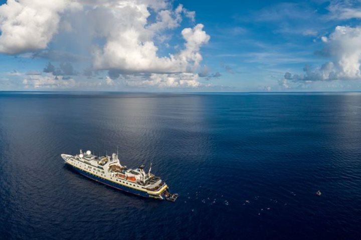
Ducie Atoll, Pitcairn Island Group
After spending two days at sea in the depths of the South Pacific, we arrived to our first destination and were welcomed by ideal conditions for our activities today. Breakfast out on deck allowed us to enjoy a dramatic sunrise that marked the start of our day. We were all very eager to plant our feet on solid ground, despite having a very calm transit over the previous two days. After breakfast we heard about the story of HMS Bounty from Alex, which has historical ties to this region while the scouting party assessed the conditions for getting to shore. The conditions could not have been better, so we were all able to spend some time exploring this tiny atoll, inhabited only by a few species of sea birds. After enjoying lunch back on the sun deck, we got ready to enjoy the water activities for the afternoon. The divers went out to get up close and personal with the rich corals and inhabitants at depth, while most of us donned our masks and snorkels and enjoyed the views from the surface in more shallow waters. The third option was to enjoy a tour in our custom made glass-bottom Zodiac, the M/V Tom Ritchee , which was captained by none other than Tom Ritchie himself. After everyone was back on board, National Geographic Orion headed west toward our next destination. But not long after getting underway, we were graced with the presence of a few sperm whales regaining their strength after making deep dives in search for prey. It was a fantastic introduction to the South Pacific and left us sun-kissed and excited for more.
4/4/2018
Watch
National Geographic Orion
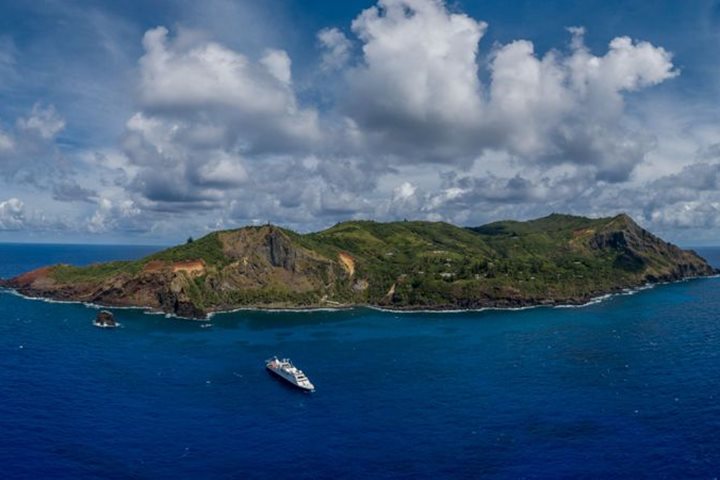
Pitcairn Island
This morning we awoke to another beautiful day in the South Pacific. Just as the sun began to rise above the ocean, we sighted our destination for today – the remotest island on earth – Pitcairn Island. The island is home to the descendants of the famous mutineers from the HMS Bounty, various bird species, and some of the most spectacular island landscape found anywhere in the Pacific Ocean. After a hearty breakfast, and a quick introduction to the island from one of the local guides, we headed ashore to explore this most fascinating place that very few people ever get to visit. Some of us decided to hike up to the very top of the island and were rewarded for our effort with a scenic 360 degree view of the island, its lush forest and the surrounding seas crashing against the shore. Most of us decided to explore at a little more leisurely pace and instead explored Adamstown, meeting her many fascinating locals, photographing the many relics on display, and even visiting the local school to be part of the day’s curriculum. In the afternoon we once again trekked across the island to the beautiful St Johns Rock Pool and relished the chance to take a dip in its refreshing clear blue waters. What an incredible day at one of the most unique islands in the world!
4/6/2018
Read
National Geographic Orion
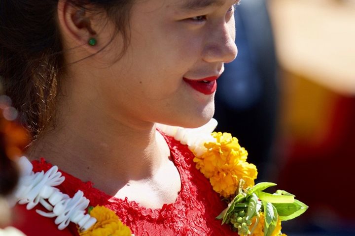
Mangareva, French Polynesia
Where can we start? This was an incredible day. We started with our ship National Geographic Orion sailing into the lagoon at sunrise. We all enjoyed the sailing and the crystal clear tranquil waters protected by the outer reef. We visited the main town of Rikitea. When we got ashore in our Zodiacs a group of locals where waiting for us with music and dancing. While the drums were making their fast rhythmic sounds, we were given flower leis as a welcome. “Iaorana!” They said as we were given hugs and flowers. We started by walking into the central part of town, where our local guides showed us the magnificent restored St. Michael’s Cathedral. Built with shaped coral stone blocks and with beautiful mother-of-pearl inlays in the main altar and the wings, this incredible building was part of the 116 stone buildings, arches, and roads that Father Laval’s mission built in the mid-19th Century. Many of the vestiges of the old city were still visible around the Cathedral site. While we visited the village, some of our guests and naturalists hiked to the top of Mount Duff, the highest point of these islands with an elevation of 1,581 ft. It was a strenuous hike that payed off with a gorgeous view of the lagoon and its motu. Later we visited the ruins of Couvent Rouru, the convent which housed 60 nuns at one time. During lunch we repositioned our ship and we visited Motu Aukena, where we enjoyed many different activities. We snorkeled between beautiful coral gardens protected by an outer reef. Some guests also enjoyed kayaking in this beautiful protected area, and we also deployed the glass bottom Zodiac with which we were able to explore the submarine wildlife that was beyond this reef. We sailed away from Mangareva at sunset with a wonderful Polynesian dinner in the open back deck. And we crowned this excellent day with a presentation by our naturalist Tom Ritchie about the superstitions of seamen across our history. A spectacular day!
4/8/2018
Read
National Geographic Orion
At Sea towards Raroia, French Polynesia
When you explore the South Pacific by ship it is inevitable that you will have to have a day at sea to navigate the vast distances between the many islands and atolls. Although, a day at sea is never a ‘wasted’ day onboard National Geographic Orion ! We enjoyed a few fascinating lectures from our natural history staff, had time to catch up on editing our photos with our photography instructors, and – of course – feasted on the many delicious meals prepared by our outstanding galley and hotel teams. But, the highlight of our day had to be a blue water swim in over 6000 feet of crystal clear blue water right in the middle of the South Pacific!
4/10/2018
Read
National Geographic Orion
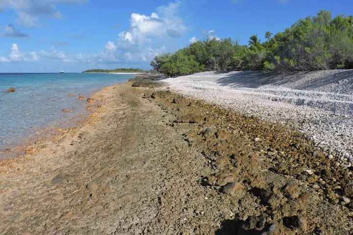
Tahanea Atoll (Tuamotu Archipelago)
Tahanea Atoll is located in the central region of the Tuamotu Group, which is part of French Polynesia. We knew very little about Tahaena Atoll, apart from what we could see on the charts, so our visit was an expedition stop. Tahanea Atoll is quite large, measuring 48 km (29.8 mi) long by 15.2 km (9.44 mi) wide. The wide and deep inner lagoon covers about 525 km² (200 mi²) and the land area covers about 8 km² (3 mi²). There are three passes on NE side of the atoll that give access to the interior lagoon, and the middle one (Teavatapu) is wide enough and deep enough to have allowed us to bring our ship right inside for an anchorage. The southern reef fringing the atoll is wider than the northern one, but the largest islands are on the narrower northern rim. There once were several small settlements here, but today Tahanea is uninhabited, although it is visited occasionally by islanders from neighboring atolls. Small groups of people come to the island seasonally to harvest coconuts and produce copra. The southern-most pass afforded us some exciting drift snorkeling in the morning. We offered two rounds of this adventure, because conditions were perfect to let our guests get swept into the lagoon by a strong, swift tidal movement. The coral is robust and healthy in the pass and it was interesting to watch the little fish struggling hard to stay near their chosen nooks and crannies while the water was pushing through. The first group of snorkelers was swept through so quickly, there was time to do it again! The second group (which included a few from the first bunch that wanted to experience it yet again) began their drift, but partway through it the flow slowed suddenly and started moving in the opposite direction! The change was so fast, they all just stayed in the water and enjoyed it. The SCUBA divers also enjoyed the reef this morning and went to the northern-most channel for another amazing underwater experience. In the meantime, nearly half of the guests opted to go ashore and explore the uninhabited motu right near the ship’s anchorage. This islet is very different from what we had experienced during the previous part of the voyage. It is rugged and composed of a solid, slightly raised dark coralline platform upon which is loose, unconsolidated coral rubble. There is virtually no sand to be seen onshore. The plant life is fascinating, as it must survive in extremely poor soil, but it is beautifully adapted to this situation and is thriving. The inner shoreline was littered with seashells, although many were broken and badly worn, and we could see lots of fish in the shallows, such as parrot fish and surgeon fish, and even an eagle ray inside a shallow tidal lagoon near the landing. We also could see some giant clams in the lagoon. As we walked about, most of us heard the beautiful songs of the endemic Tuamotu reed warbler…and a few of us even managed to see one. After lunch, we organized more water activities. The snorkelers went out again, only this time they explored the inner reef system by way of the wonderful snorkel platform. The SCUBA divers went to a different dive site from the one they experienced in the early morning. In addition, the glass-bottomed Zodiac (GBZ) was put in the water in order to revisit the southern-most pass and show it to those who didn’t get to see it earlier. It was quite fun to shut off the engine of the GBZ and let the current take it through the pass as we witnessed standing surface waves along either side and robust coral below us. Everyone returned to the ship in the late afternoon around tea time, so there was still enough sunlight for the Captain to see his way safely back out of the lagoon and get us underway towards our next destination.
Showing 12 of 551